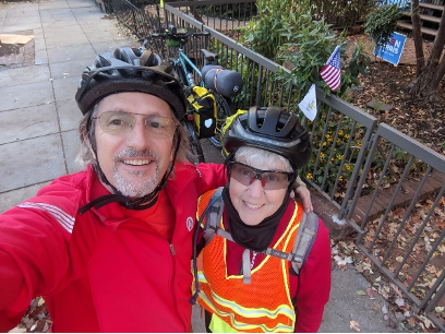
DC to Harrisonburg on the Valley Route, November 4-8, 2020
by Stephanie Kaufman
Last winter, pre-COVID, we were in the planning stages of doing the first segment of the Great Divide Trail on a tandem bicycle. Due to COVID19, and following the guidance of the Adventure Cycling organization, those plans were scratched. When we read about the TransVirginia ride in the October/November issue of Adventure Cyclist magazine, the idea of doing a similar ride closer to home was born. However, the tandem mountain bike we had ordered was still in production, so we decided to use our current bikes: a Kona DewPlus with upgraded tires and a Surly Troll with a BOB trailer in tow. Neither of us had ever done such a ride before. We had both ridden the C&O and GAP trails and done major hill climbs on road bikes but I don’t think anything could have prepared us for the climbs on gravel roads that we would encounter over the next few days. Although the TransVirignia website indicated that the best months to bike the trail were from April to October, the forecast of warm weather in the days after the election was all the encouragement we needed to get on our bikes and go beyond the Beltway.
Wednesday, November 4
The plan was to leave DC on the morning after the election, with a slim hope that we would know who the president-elect would be. But as we rolled out of town that morning, there was dew on the grass and the country was still in limbo. It would be many days before those results would be known.
Riding from Dupont Circle to the Capital Crescent trail and then the C&O, passing Great Falls, gradually escaping the gravitational pull of the city, we eased into the quiet woods along the C&O canal. The fall colors reflected in the clear water to create a colorful landscape. Our goal for the first day was modest: camp at Turtle Run campground at mile 35. We arrived early to make camp, take time to meditate, practice some yoga and check our newsfeed. As soon as the sun went down it got quite chilly and we enjoyed a hot dinner of fried rice and hot chocolate. We were able to make a roaring campfire thanks to the generous efforts of an unofficial camp host who left a pile of wood ready for burning. Miles ridden: 35
Thursday, November 5
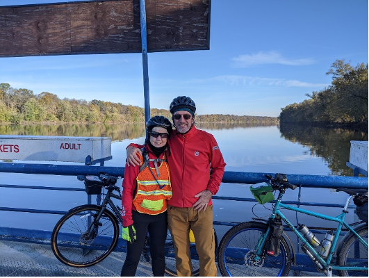
A quick, nutritious and delicious breakfast of Apricot-Coconut oatmeal, premixed at home so all we had to do was boil water, and we were on our way. We were the only passengers on White’s Ferry, crossed over the Potomac and wove our way through suburban streets until we connected to the W&OD trail to Leesburg and then to Purcellville. We stopped along a country road to eat some lunch, which attracted the attention of a little girl. She went to grab her dad – uh oh – were we trespassing? Not to worry, they were friendly folks who were similarly enjoying the fall weather. Later that afternoon, we met our first challenging hills and even walked a few, as we approached Bluemont, stopped for some fresh hot apple cider, apple cider donuts and pizza at a road side farm stand, and arrived at Bear’s Den campground at mile 65, eager to check our news feed. Nada. After a delicious dinner of Chicken Marbella and rather obsessively checking our newsfeeds one more time we happily slid into our tent and fell asleep.
Miles ridden: just 30 but felt like more due to the climbing
Friday, November 6
Bacon and eggs for breakfast? You bet. With precooked bacon and powdered eggs. Really good. And we were off. Today’s destination was the historic Wayside Inn in Mididletown, mile 104. Halfway through this trip, we were ready to sleep in a bed and enjoy a hot shower. The day started with a climb up the busy Harry Byrd Highway but before long we left the trucks and were riding alongside the Shenandoah River.
Miles ridden: 39
Saturday, November 6
Today’s goal was the most ambitious of the trip – 57 miles to a primitive campsite in the George Washington National Forest. We were quickly learning that 57 miles on a road bike on paved roads does in no way equal 57 miles on gravel roads. The climb today was more challenging than the previous ones as we literally crawled up Zepp Road. At the top, at Fetzer Gap, we were greeted by a beautiful view and a mobile phone tower.
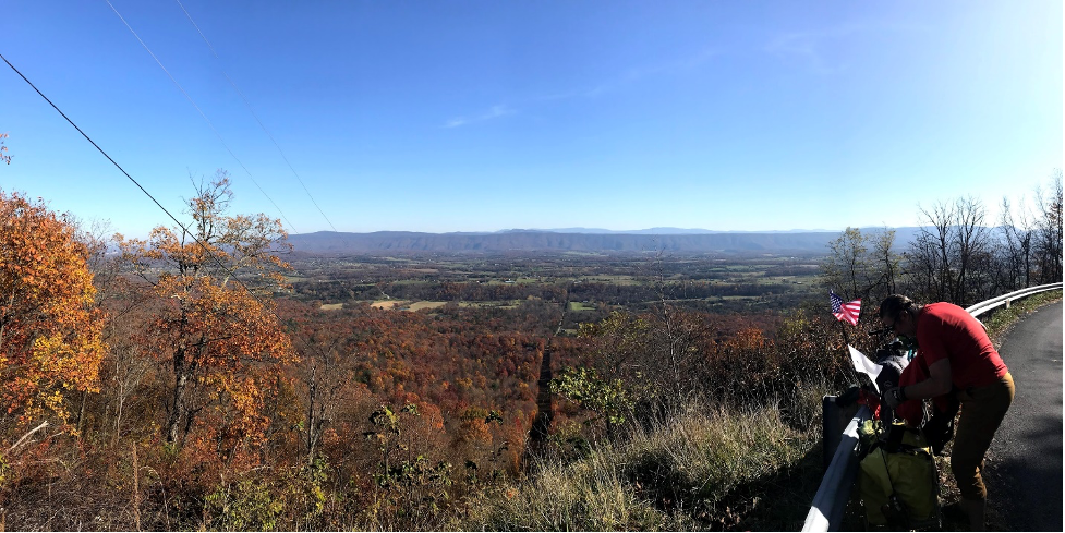
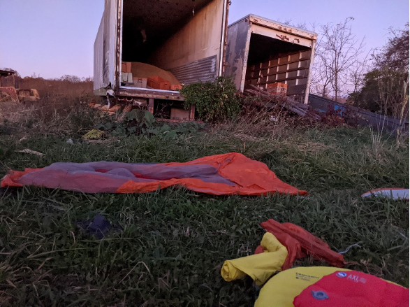
Finally, we read the election results while devouring a snack of apples and goat cheese, purchased earlier in the day at Richard’s Fruit Market. We cruised down the mountain to Alonzaville and stopped for a bite at Ridge Runner Farms and Brewing Company to fortify ourselves for the final leg of our journey that day. Night was falling quickly, and as the sun went down, so did the temperature. It was looking more and more like we were not going to make it as far as we had planned. The thought entered our minds that this might be the night that we would need to experiment with “stealth camping.” We were keeping our eyes peeled for an abandoned building where we could pitch our tent, away from the road and out of view of passing cars. Eventually we spotted a barn that seemed to be out of use, with miscellaneous farm equipment scattered about. When the sun set, we pitched our tent out of view from the road, between the various pieces of farm equipment and the barn, and slipped into our sleeping bag, without turning on any lights or even making dinner.
Sometime later, a truck pulled up beside our tent. It seemed to pass us, then turned around and directed its headlights onto our tent. We held our breath and squeezed each other’s hands tight, scared to death of what might happen next. Then a voice asked us what we were doing there. Unzipping the tent flap, I gingerly stuck my head out and explained our situation and begged forgiveness. We offered to pay him and to move camp. He said not to worry about it but not before reminding us that this was his property. We promised to be gone by 7 a.m. He seemed satisfied and left us to sleep there. That night we had a full moon, and true to form, the sounds of coyotes howling woke us in the middle of the night. This was a night we would not soon forget.
Sunday, November 7
We ate breakfast, packed up the tent and were on our way, the last day of this adventure. Having accidentally reset the odometer, I’m not sure how far we went the day before, but regardless, we had some significant mileage to make up. One issue that plagued us throughout the trip was having sufficient battery power for our cellphones. Even in airplane mode, with backup batteries, and with only Ride With GPS running in the most battery saving way possible, we were in danger of our cell phones running out of power. We took turns navigated so the other could shut off their phone completely. We charged our batteries and phones as time and location permitted, at gas stations and fruit stands, here and there. Coming out of Bayse and Orkney Springs we met the mother of all hills, nearly a vertical climb which we thought would never end. We were hoping for a nice view on the ridge to reward us for our efforts and have lunch. But that turned out not to be the case. The ridge was populated with vacation homes, clearly located there for the view that we were hoping to glimpse. Perhaps because of exhaustion, the details of the rest of the day are foggy. We knew we had to get to Harrisonburg. That was all that mattered. As we left the forest environment, the woods gradually gave way to the valley and open farmland. We still had to face the ups and downs and undulating hills, some which were quite steep and we had to walk. The world of gravel roads was now behind us; we now were back on asphalt roads. Finally, we were greeted by a big downhill to the main highway. As night fell, we rolled into Harrisonburg and a bed for the night, happy and tired.

