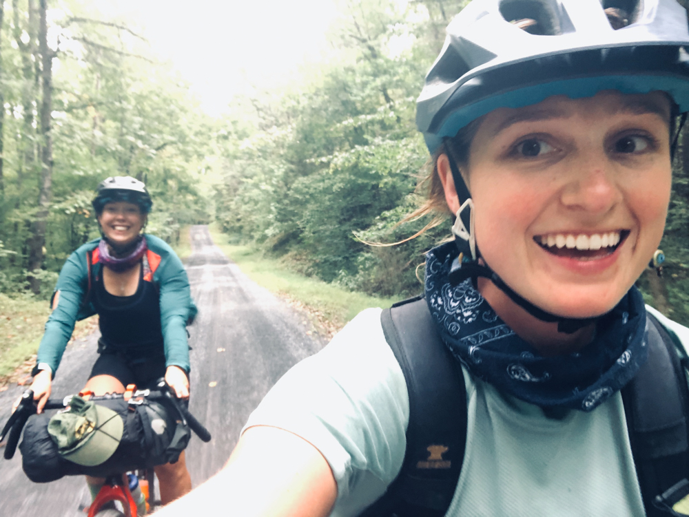
Jess Daddio & Lindsey Carpenter’s TransVA Ride, September 2019
By Jess Daddio
Jess / @jessdaddio
Lindsey / @lizzyclaw (+TransVA Story)
Day 0
It is rush hour in Washington, D.C. My friend Ellen has graciously agreed to drive Lindsey and I to my brother’s house in downtown D.C. On a good day, it’s a solid two-hour drive from our homes in Harrisonburg, Virginia, but it’s nearly three hours before we start to see the tip of the Washington Monument.
As we inch closer and closer into the heart of the capital, our excited pre-trip chatter turns quiet. It takes all three of us, heads on the swivel, to navigate through the city’s web of one-way roads and abrupt traffic-turned-parking lanes. We find a tight parking spot on the street facing my brother’s house and coach Ellen through a parallel park job.
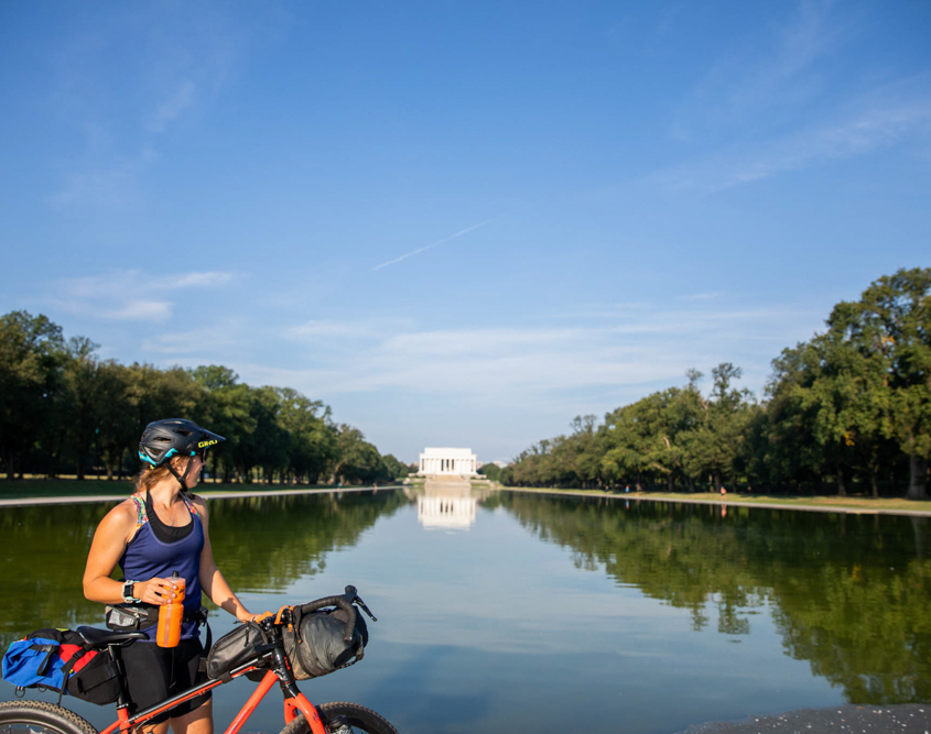
My brother and his fiancé live about a mile from our starting point on the National Mall. We say goodbye to Ellen and promptly take over my brother’s living room with our bikes and gear. With the next day’s temperatures forecasted to be in the high 90s, we plan to hit the trail at first light.
Day 1
Washington, D.C. > Watermelon Park
79.77 miles, 2,934 feet
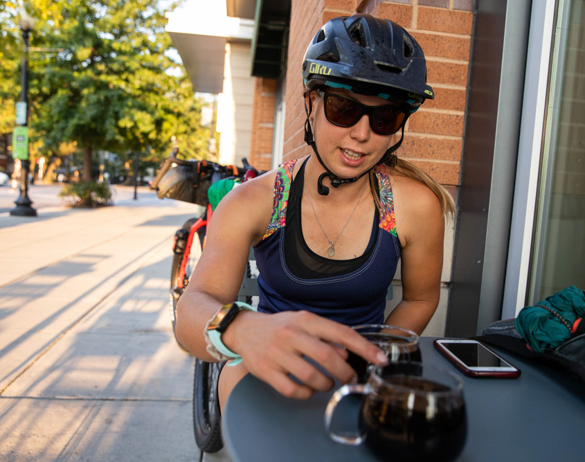
At 7 a.m., we roll out in search of coffee. The streets are relatively quiet compared to the bumper-to-bumper traffic from the night before. We spend $5 each on a pourover from Blue Bottle and settle into a table outside. It’s a Thursday morning and the sidewalks are crawling with men and women in professional dress. The sun is already blazing hot so we don’t linger long. By 8 a.m, we’re weaving through the morning commute, feeling entirely out of place with our loaded bikes.
The first 36 miles follow the Chesapeake and Ohio Canal Trail. The crushed gravel path rolls fast. We spot a blue heron preening and stop to take his photo. The humidity is so thick beneath the canopy that my skin immediately beads with sweat.
It is early afternoon by the time we get to Whites Ferry. We buy cold drinks and salty snacks and revel in the luxurious air conditioning before loading onto the ferry. It’s a short ride across the Potomac, which is stagnant and steaming in the summer sun.
Around mile 43 we hit another bike path, this one the Washington & Old Dominion Trail. It’s paved but graded slightly uphill. The temperature is pushing 100 degrees with 100% humidity and I’m starting to feel sluggish.
We leave the bustle of Purcellville behind at mile 54. From here on out, the route is mostly quiet country roads and gravel Forest Service roads. After 60 miles of intense sun exposure, my brain feels fried. We take a break in the shade of an old oak tree and I bum some Skratch off of Lindsey. The lack of electrolytes is taking its toll. When Lindsey asks me “right or left?” at the next junction, I respond, “yellow.”
In Bluemont, we stop at the country store and gorge ourselves on Route 11 potato chips and hard-boiled eggs. The next stretch on Route 7 concerns me — it’s officially rush hour and we’ll be following the same westbound lanes as everyone else zooming 60mph down the mountain. Traffic aside, the shoulders are littered with broken glass and hardware. The last time I rode this section, I put a nail in my rear tire. Another guy who rode the TransVirginia before me shredded his sidewall here, too. Fortunately, the first two sections of Route 7 provide a sizeable shoulder for Lindsey and I to ride, but the last section is completely shoulder-less. It takes us 10 minutes of waiting in a driveway to find a gap to shoot through in order to make the left turn by Nalls Farm Market.
With the Route 7 madness behind us, the last miles to Watermelon Park are blissfully peaceful. Within minutes of arriving at Watermelon Park, my parents arrive with puppies to play with and Chipotle to devour.
Day 2
Watermelon Park > Van Buren Furnace Primitive Camping
53 miles, 4,178 feet
It’s a stifling hot night by the Shenandoah River. Lindsey and I both sleep fitfully. The morning is cool and cloudy. We take our time getting ready—we have all day to ride 53 miles to our next campsite where friends will be joining us for a couple of days.
The route from Watermelon Park meanders along gravel roads paralleling the Shenandoah River. The countryside is dotted with sprawling horse farms and endless miles of hand-built limestone walls. The short day is a blessing. Lindsey is battling a cold and feels tired. At a church in Bunker Hill, we stop for what feels like an hour, lounging on the sidewalk and indulging in the sunless afternoon.
We stock up on more Route 11 potato chips at a gas station in Wheatfield before entering the George Washington National Forest. By this point, my bottom bracket has started to click incessantly. It’s only 4pm when we get to camp and our friends aren’t expected until 7pm. The creek behind our campsite is bone dry, so we walk back to the last place we saw water about a half-mile away. We try (and fail) to start a fire. We set up our tent and hang up our sweat-soaked riding clothes in the hopes they’ll dry in the humid evening air (they don’t). We cook dinner and stew over our failed fire. The party train of friends finally arrives, bringing with them more snacks and water. Ellen and my boyfriend Adam have their bikes and gear and will be joining us for the next two days, which cover some of the steepest and rockiest terrain of the entire TransVirginia.
Day 3
Van Buren Furnace > Switzer Lake
76.24 miles, 8,431 feet
We’re climbing right out of the gate, first on washed out singletrack and later on gravel roads. The climb up Devils Hole is socked in with fog and shrouded in mist. A usually reliable spring on the climb is completely dry. Near the top, the leaves are already changing color.
The descent off Devils Hole is wicked fast. We peel out of the clouds and into sunshine, cruising toward Lost River and the little unincorporated community of Mathias, West Virginia. We eat lunch at the gas station before setting out for the next major climb up German River Road. The climb is slow-going and rocky but rideable, even on fully loaded rigid frame mountain bikes. Again, the riverbed is completely dry, so we ration our remaining bottles of water, praying that Switzer Lake will have surface water.
The sun disappears behind the clouds as we crest the top of the German River climb. Thunder rumbles overhead and it starts to pour rain. We huddle beneath a tree, and within minutes, the rain has passed. The section along Hall Springs Road is completely overgrown with stinging nettle and briars that rip at our skin. We can hardly see the doubletrack beneath our tires.
Finally, we pop out onto pavement and speed down Route 33 toward Switzer Lake. We’re in luck—one of the creeks feeding into the reservoir is still running with water. We fill up all of our water bottles and dromedaries and pedal up the road to find camp.
Day 4
Switzer Lake > Shaw’s Fork Equestrian Campground
~52 miles, ~5,100 feet (Strava died)
We putz in the morning, dreading the act of putting on a wet chamois for the fourth day straight. Everything is soaked from the relentless humidity. We again ration our water for the big climb up Dunkle Hollow to Flagpole Knob, unsure of whether or not the spring on Flagpole will have water (it does not). Compared to German River, the climb up Dunkle Hollow feels short and sweet. We run into an amateur radio club car camping on Flagpole. Someone in their posse is cooking bacon and eggs and the smell is terribly tantalizing, so we continue down the road until we find an unoccupied clearing to eat our bars and dry our gear.
As we descend Forest Service Road 85 off the backside of Reddish, we pass friends from Harrisonburg climbing in the opposite direction (the notorious “Death Climb” section of the Shenandoah Mountain 100 mountain bike race). We stay on Forest Service gravel for the vast majority of the day until we reach the country store in West Augusta.
By now, Ellen has left us to return to the real world. It’s just me, Lindsey, and Adam. At the gas station in West Augusta, I park my butt on the curb and crush a healthy helping of french fries, deviled eggs, and (Mountain) Dew Cake. Our final miles are all on pavement and, with the exception of the climb up to Confederate Breastworks, fairly mellow. It’s just 5pm when we get to Shaw’s Fork. Built with equestrians in mind, the campground only has two tent pads, but there is plenty of flat, open ground, pit toilets, and a creek which is still barely flowing.
Day 5
Shaw’s Fork > Covington
69 miles, 6,385 feet
In the morning, we’re treated to a real breakfast of eggs and coffee, courtesy of Lindsey’s boyfriend Sam. The first 30 miles are a mixture of quiet pavement and gravel and are practically free of cars. Adam splits off midday and we say farewell to our last riding companion. From here on out, it’s just me and Lindsay.
We reach Douthat State Park shortly after lunch and stop at the park store. It’s hot, and water is still hard to come by, so we bitterly buy water bottles and fill up before the last stretch into Covington. After a few miles of battling spider webs and overgrown doubletrack in the park, we pop out onto more Forest Service gravel roads. It’s a steady climb up McGraw Gap but the scenery is gorgeous and backlit by golden hour light. We rip down Dolly Ann Hollow, which turns from gravel to pavement. We can smell Covington (home to an active paper mill) long before we see it.
In town, we check in at a Quality Inn with enough hours remaining in the day to do laundry and resupply. Despite feeling out of place in our spandex shorts, the locals are incredibly nice and curious.
Day 6
Covington > Eggleston Springs Campground
75 miles, 9,028 feet
It’s a big pavement climb out of Covington up Hays Gap. We almost miss a young black bear shimmy down a tree that’s bordering the road. Within a couple of hours, we come upon a road closure on Rich Patch Road. Deciding to take our chances, we continue down the closed road anyway, only to discover that the VA Department of Transportation is two months into a bridge rebuild. Fortunately the VDOT team is extremely nice. They let us use their catwalks to cross the creek and even offered to hoist our bikes back up the bank with a crane.
The following section is relentless with 2,000-foot climb after 2,000-foot climb. The gravel ascent up Potts Mountain is chunky and punchy and little used. Lindsey and I swap leads to give each other a break from the constant spider-webs-to-the-face. We’re running low on water and getting worried. Potts Creek and all of the nearby tributaries are completely dry. Neither of us has ever seen Virginia this dry.
Finally we come upon a piped spring that’s pumping cool, clear mountain-fed water. We splash our flushed faces with water and relax in the comparable shade of the spring oasis. There’s two more big climbs ahead and we pedal on, slow but steady. The climb up Little Mountain is stout but beautiful in the golden hour light. The temperature is cooling off to the point that we’re still sweaty when we ride but chill when we stop. After climbing the final bit past Mountain Lake, we rip off the backside down Doe Creek Road, putting up camp on the New River at Eggleston Springs Campground. We’re so exhausted from the day’s 9,000 feet of climbing, we hardly notice the trains that rumble through every hour.
Day 7
Eggleston Springs > Comers Rock
97 miles, 8,086 feet
We break camp early to start what would become known as “The Big Day.” I stop at J&J Grocery within the first couple of hours for a $2 egg and cheese biscuit. The gravel country roads between Eggleston Springs and Pulaski are bucolic, winding through farms and passing by quaint country churches.
At the base of the climb up Little Walker Mountain, we have our first and only two dog encounters of the trip, both of which occur within 15 minutes of each other. Shaken, but not harmed, we continue on to make the extremely steep (but short) climb up Little Walker Mountain.
We climb into a thick cloud and don our warm layers for the brisk descent towards Pulaski. It’s drizzling rain and cold, and all I can think about is hot coffee. Unfortunately, the only resupply on route in Pulaski is the Dollar General, which does not brew coffee. While we resupply, my lips turn blue and my joints stiffen. We cram some calories in our face and quickly start pedaling again to get the blood pumping.
Lindsey lays down a fast pace on the New River Trail and we hammer hard for two hours. We have just over 30 miles of rail-trail we’re trying to knock out by lunchtime. Though the gravel rolls fast, and there’s nothing in the way of navigation or climbing, the rail-trail miles feel almost harder than all of the thousands of feet we’ve climbed in the days prior. We blitz past a group of roadies who then sprint past us to their cars. Around mile 70, we leave the rail-trail miles behind and begin climbing up and up and up, into the Mount Rogers National Recreation Area.
We encounter another road closure on Forest Service Road 690 but again decide to take our chances. There’s a bulldozer blockading the road, forcing us to bushwhack through the dense rhododendron to get around.
We climb and climb and climb some more, and the more we climb, the more the temperatures drop. Finally, after close to four hours since leaving the New River Trail, we descend to Comers Rock, a small six-site campground on route. We have both completely run out of water at this point, and after setting up our tent, we immediately head to the water spigot. It doesn’t turn on. There’s only one other campsite which is occupied by the campground host. He offers us a jug of water to use for the night. A friend of his pays for our campsite and we stumble, grateful but starved and fatigued, back to our site to make dinner and pass out.
Day 8
Comers Rock > Damascus
68 miles, 6,239 feet
It is legitimately cold in the morning. Lindsey and I wear all of the warm layers we’d been carrying around for a week — long-sleeved shirts, vests, wind shells, gloves, leg warmers — and hit the road. The sun shines brilliantly on the Highlands and warms up the temperature to a comfortably cool autumn-feeling morning. There’s a 15% grade on gravel that we tackle early on, grateful it comes earlier rather than later in the day. We stop in Sugar Grove for more snacks. I load up on fresh-baked apple hand pies and hot coffee (success!) at The Farmhouse Market.
Local TransVirginia rider Eric Grossman (who at that time held the FKT) intercepts us at the base of the last climb up to Elk Garden. We use his floor pump and chat for a few minutes before setting out for those final miles. The top of Elk Garden is so cold and windy, we don’t hang out long to celebrate, choosing instead to descend all the way to the Whitetop station at the start of the Virginia Creeper Trail. It’s a blissful 17-mile descent from Whitetop to Damascus and to the red caboose in town, the official southern terminus of the TransVirginia!
Some notes:
- Lindsey and I both rode Salsa Fargos with at least 29 x 2.2 tires. You could get away with skinnier tires, but the extra width made descents on gravel way more fun.
- I’m a vegetarian and Lindsey has a number of dietary restrictions (no gluten, dairy, soy, corn, or nuts). I did not have a hard time finding things to eat and resupply with on route, but Lindsey could not rely on gas stations and Dollar Generals for her resupply. She organized her own resupply, which she received at Shaw’s Fork, and carried more days worth of food than I did.
- While we rode through an especially rough dry spell, in general, surface water is easy to come by on the route. We both carried only two bottles and did not feel like we needed to carry more than that, even with the drought.
- Route 7 (Day 1) is EXTREMELY BUSY, no matter the time of day. If you are aiming to get to Watermelon Park on day one, START FROM D.C. EARLY. You do not want to be on Route 7 during rush hour. It is sketchy and dangerous and the final few miles do not have a shoulder at all for cyclists to ride on. If you find yourself approaching Route 7 near rush hour, ride a couple of miles off route and stay the night at Bear’s Den so you can descend Route 7 the following day. The morning traffic will be heading eastbound, which means you will avoid the worst of it since you are heading westbound.


